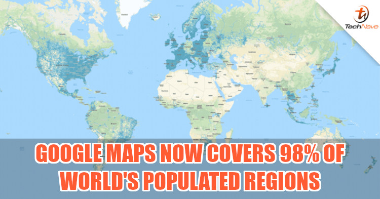
There was once upon a time when mankind knew not about the world outside of his surroundings. Today, much of our world has been mapped out, with Google claiming that Google Maps now covers up to 98% of the world's populated areas. The platform now provides us with a closer look at more of the known world than ever before.
According to a recent blog post by Google, Google Maps has collected billions of images from around the world for years using several methods, like cars equipped with cameras and trekkers carrying customised backpacks. To date, Google Earth boasts over 57 million square kilometres of recorded images, showing people across the world other locations that they may never get to visit.
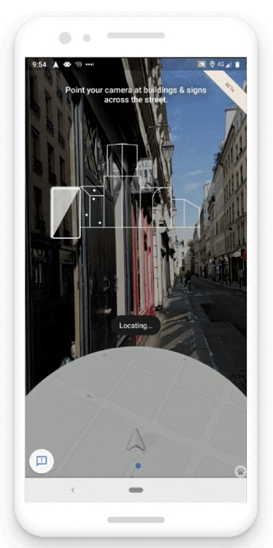
Using all the images that have been collected, Google then stitches related ones together to provide greater detail or information of the area shown. This could be a top-down view of a city, how a street looks, and where different buildings are located. Google Maps also has a Live View feature that uses augmented reality to show you which way to go, handy for travellers who have a bad sense of direction. In all, it's interesting to see how much Google Maps has done over the years.
However, would you be contented to just view a famous location through a monitor, or would it motivate you to travel there for real? Do let us know what you think of this on our Facebook page. Also, for more news like this, stay tuned to TechNave.com.


COMMENTS