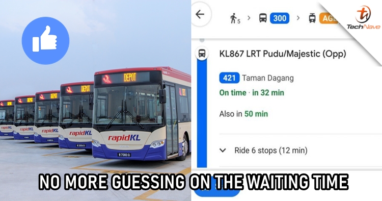
Using public transportation can save your time from being stuck in a horrible traffic jam. Not only it helps with that, but it can also save your money if you're using travel passes that come with a special rate like the MY30. However, there are some who don't like the idea as waiting time for public buses can be uncertain and sometimes it'll take too long. To make changes, RapidKL announced that the waiting time for selected RapidKL, Go KL, LRT, and Smart Selangor will now be displayed on Google Maps in real-time.
It is stated that the waiting hours of a total of nearly 170 bus routes in the Klang Valley can now be found on the navigation app. The app will let you know which bus you'll need to take with the number and show you the waiting time when you're planning to go somewhere. Therefore, it looks like there will be no guessing game anymore for those who frequently take public transportation.

The real-time integration was made because MyRapid has received 60 percent of inquiries regarding the position or frequency of buses waiting for passengers. With this feature, users definitely will have a better experience when it comes to using public transportation. However, it is mentioned that the feature is now only available for bus services in Klang Valley, with plans to expand it to Rapid Penang in Penang and Rapid Kuantan in Pahang.
Let us know what you think about this good news on our Facebook page. Stay tuned to TechNave.com for more viral local tech news.


COMMENTS