When it rains, it pours and for some in Malaysia, this also means continuous heavy rains that can cause landslides and massive floods. This can result in water damage for submerged houses and vehicles, even loss of life so it's very important to find out where it might rain and for how long.
Thankfully, there are several online Malaysian platforms that provide reliable weather information. And no, I'm not talking about the basic, sometimes inaccurate weather app on our phones. Instead, here are some websites and apps you can follow to track various weather conditions or natural disasters.
Malaysian Meteorological Department (MetMalaysia)
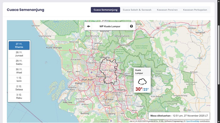
First and foremost, there's the Malaysian Meteorological Department. Also known as MetMalaysia, this department has a website with weather forecasts. It even tracks earthquakes, tsunamis, and cyclones, which can occur in our region.
The MetMalaysia website has a weather forecast section on the homepage. It displays the day's temperature and weather in cities like Kuala Lumpur or Johor Bahru, similar to the basic weather app or widget you'd find on a smartphone. However, MetMalaysia is more reliable as it's typically more accurate. You can also check the interactive map on the site for a clearer view.
MetMalaysia also issues warnings for continuous rain, thunderstorms, or rough sea conditions. The first two are more relevant for most Malaysians, but typically come in the form of a written notice. Although it's not very detailed, this gives flood-prone regions enough early warning to evacuate and prepare if necessary.
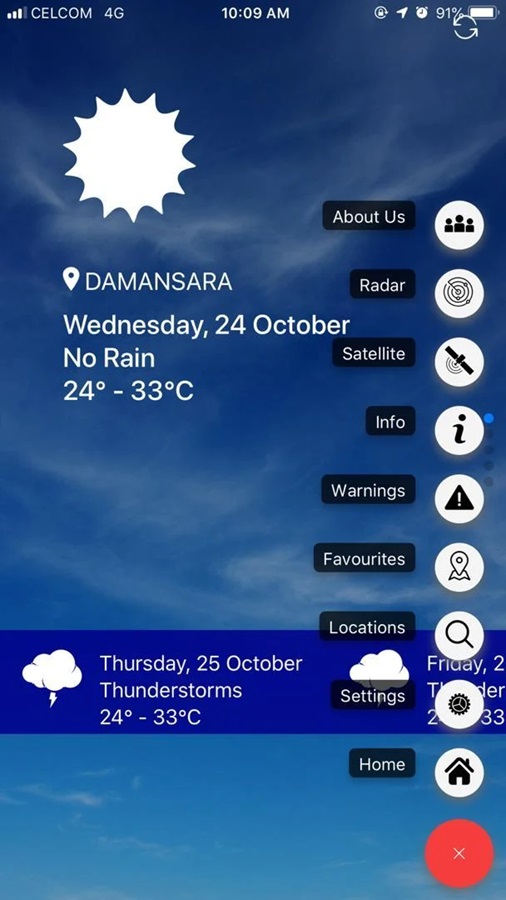
Of course, you can also go for apps like MyCuaca. It doesn't have the prettiest UI, but it has all the relevant weather alerts you'd need in Malaysia. You can find the download links (for iOS and Android) here.
Public Info Banjir
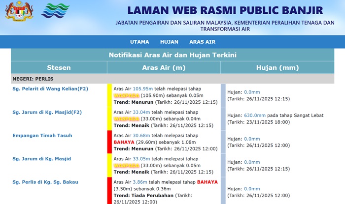
If you prefer knowing how bad a flood can be or is becoming, Public Info Banjir is probably the more accurate platform. The website displays locations where there could be flooding, water levels of affected rivers, the rain count, and more.
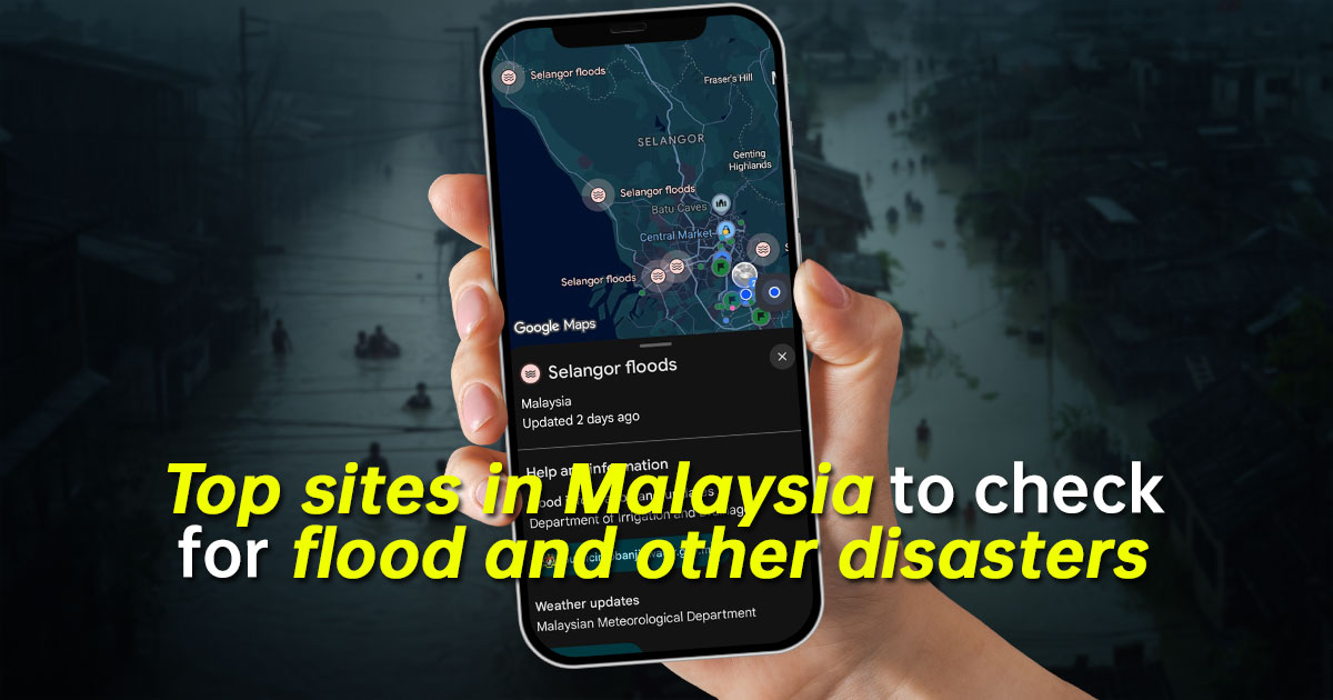
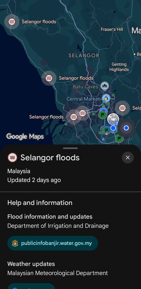
It's a non-interactive platform that only displays information, but provides much more detail for residents in flood-prone regions. If you can see a nearby area to your home gradually becoming more dangerous then it wouldn't hurt to keep your important documents in floatable waterproof containers and then explore where to go to get to higher ground. There's a mobile app for those who want to check on the go. And Google Maps can also retrieve weather info from Public Info Banjir.
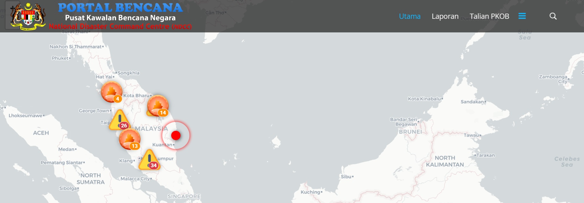
Portal Bencana
For a more interactive option, check out Portal Bencana instead. This website has a Google Maps-style interactive map front and centre on the home page. It has toggles for continuous rain warnings, flood alerts, poor air quality, and even road closures so it's helpful if you're worried about getting caught in flash floods.
On top of that, you can scroll down the home page for quick access to the many other websites and platforms. These are quick links to the different weather departments in Malaysia, such as the MetMalaysia and Public Info Banjir mentioned above.
Anyway, that about wraps it up for the relevant online platforms that track weather conditions in our country. We hope that this might help you avoid and prepare for floods and heavy rains in Malaysia for 2025 and beyond. If it was helpful to you, please let us know in the comments below. Also, stay tuned to TechNave for more articles like this.


COMMENTS