Google has been trying to unify and add many different features into the Google Maps app to make it a one stop app for exploring, moving around and planning your journey even on public transport. The latest update makes traveling on public transportation even better as predicts what the conditions and delays the public transport would be like, perfect for us Malaysians who are always looking to ditch our cars and take the LRT or bus.
The first update is for buses. It shows live delays and will also show how long a bus route would take based on the average time the bus takes to go through the route before arriving at your desired stop point. It also takes traffic into account based on live traffic updates and will show how much extra time taking the particular bus would take.
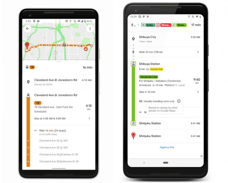
(Left) Bus route, (Right) Train conditions
The next update shows the predictions for how crowded public transport can be at certain times. Google had actually been collecting data from users about how crowded public transportation such as trains and buses are at certain times through Google Maps. The app will now warn users when it will be crowded on a train or bus and can also predict if there will be any seating or standing room on your trip.
This Google Maps update is currently rolling out on both iOS and Android to over 200 cities globally. With how unpredictable Malaysia’s public transport is, it makes me wonder if this app will be able to change that. What do you think? Will this update encourage you to ditch your car in favour of public transport? Keep up with the latest app news and updates on TechNave.com!


COMMENTS