With the COVID-19 remaining a threat in many countries, restrictions on travel and transport are put in place by many nations to curb the infection rate. It's not as bad for Malaysia now, as we're now in the recovery movement control order (RMCO) phase that has fewer travel restrictions. For other countries, Google Maps has now been updated to provide new info that will help you better plan your travel or commute around COVID-19 restrictions.
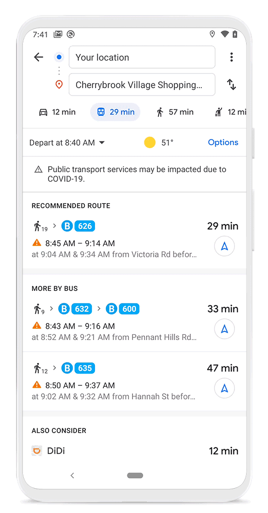
In a recent blog post, Google announced the new updates for Google Maps in Android and iOS. The first feature is a transit alert system, which will inform you if you're taking public transport that may face COVID-19 restrictions. This is relevant to countries that have restrictions, including Argentina, Australia, Belgium, Brazil, Colombia, France, India, Mexico, Netherlands, Spain, Thailand, United Kingdom and the U.S.
 |
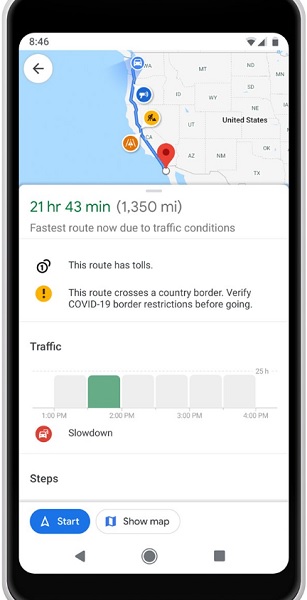 |
Besides that, Google Maps will now send you alerts if the route you plot for your drive will go through checkpoints, such as those on the country borders. However, this is only applicable in North America (Canada, Mexico, and the USA) for now. Other features include navigation to medical facilities and the ability to see whether a public transport hub (like a train station) is crowded.
While most of the new features are largely irrelevant, the last one is useful to let you avoid crowds, reducing the risk of a COVID-19 infection. But having said that, do you think these features will be useful for Malaysia? What other features would you like to see in Google Maps? Let us know on our Facebook page and stay tuned to TechNave.com for more news.


COMMENTS